May 052020
 

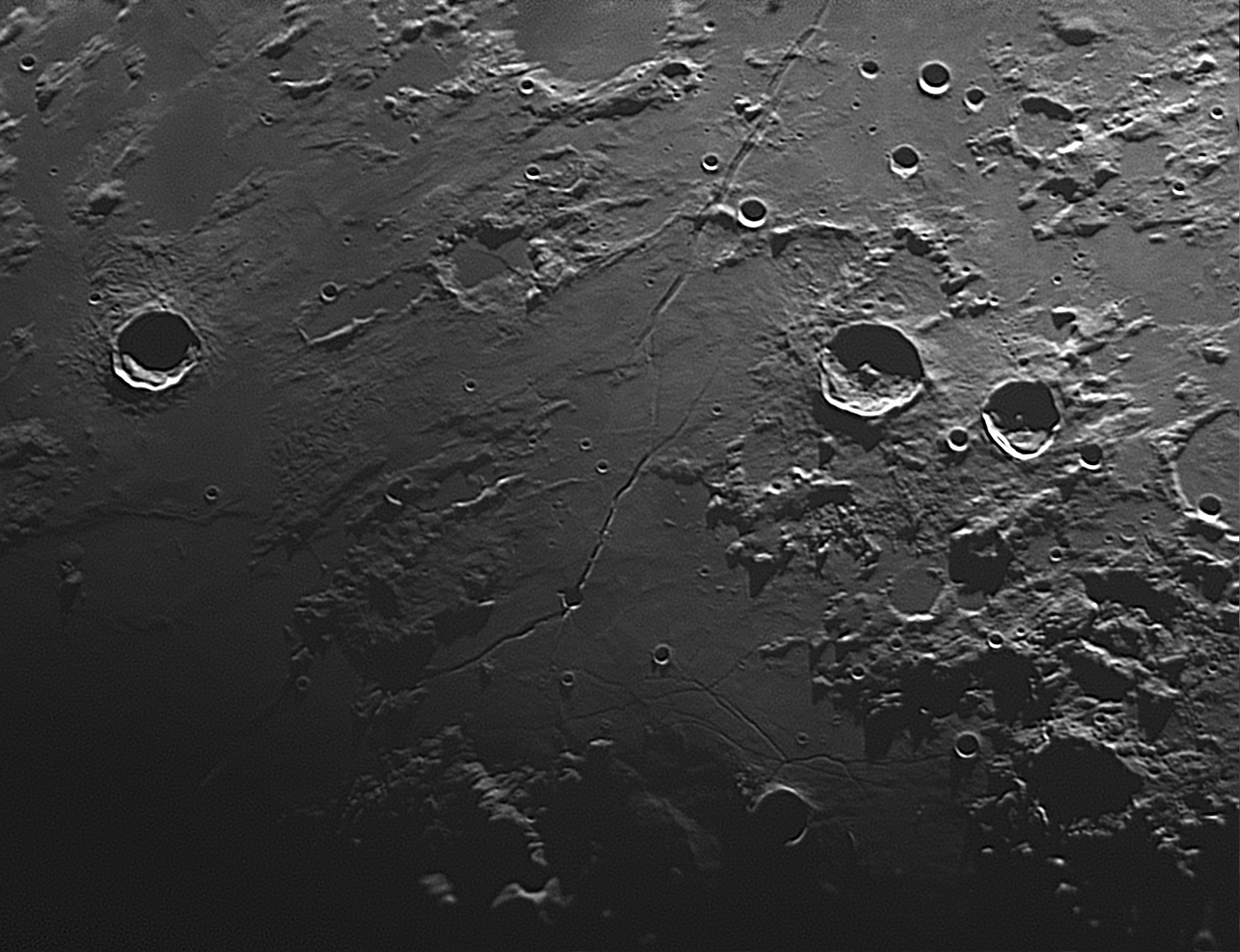
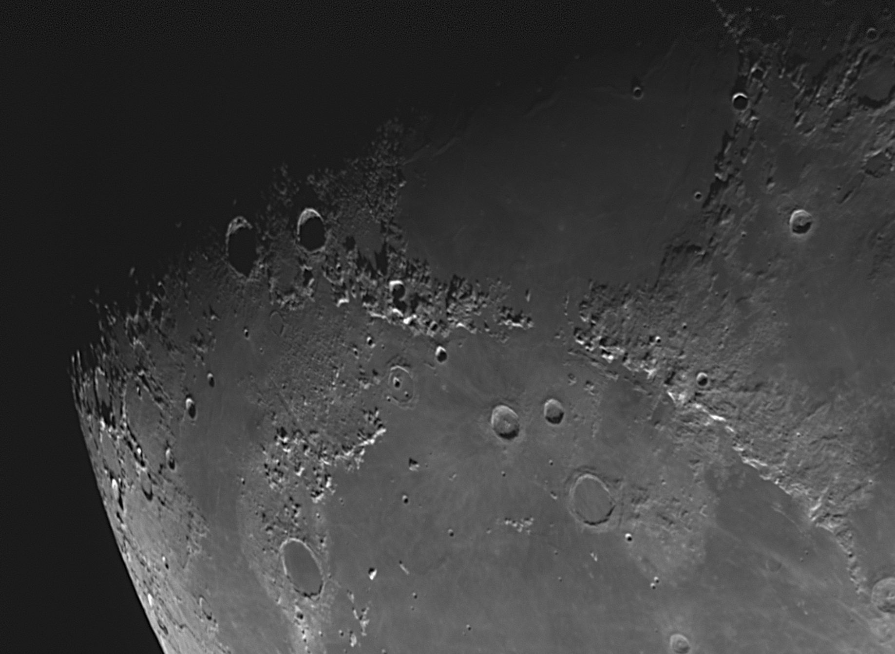
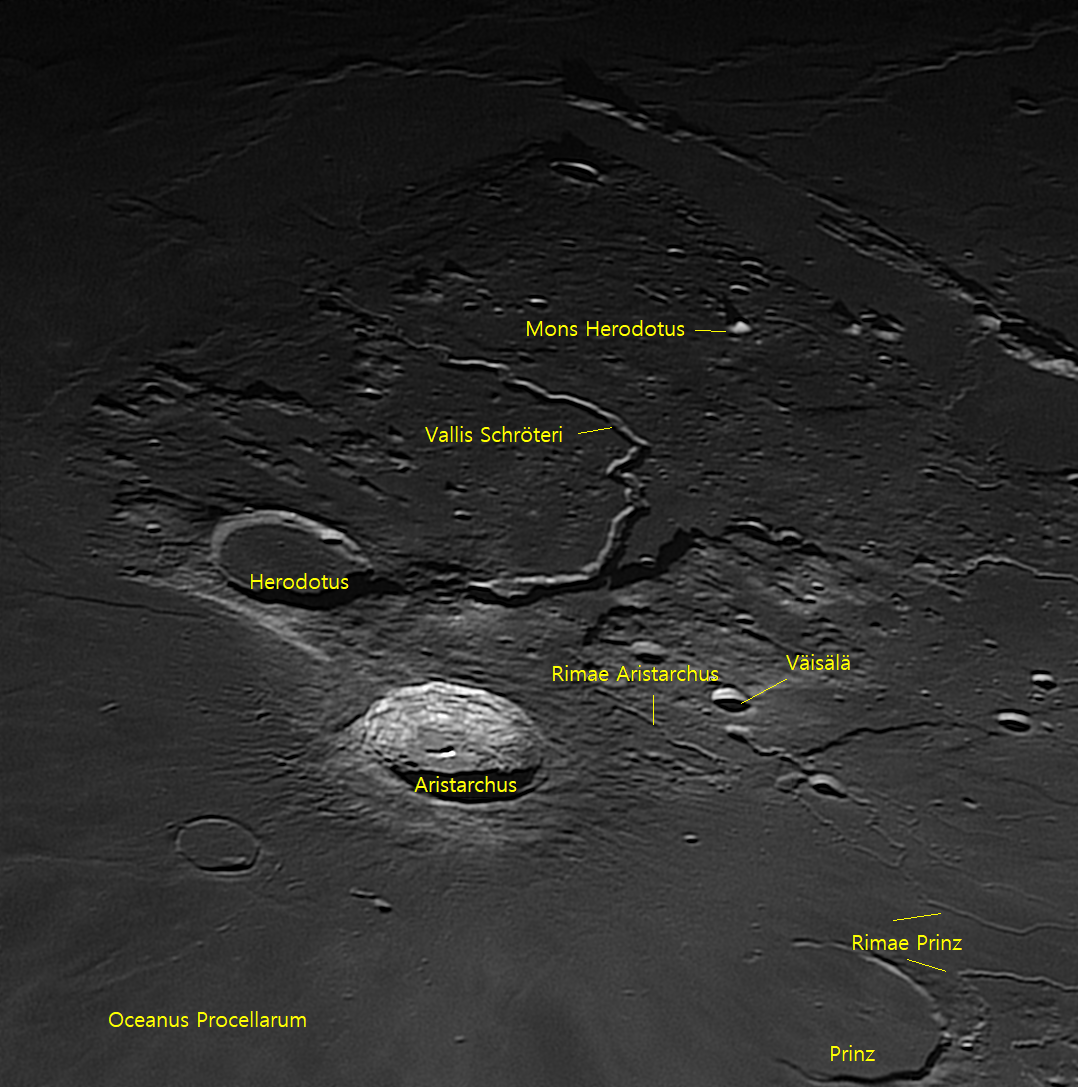
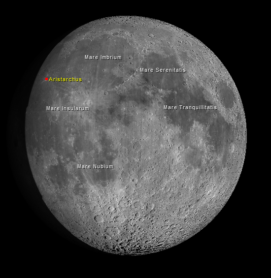
Lunar morning skies light up the twenty-five mile wide crater Aristarchus. Because it is one of the more recent impact sites on the Moon it is also one of the brighter. Solar radiation has not have enough time, 450 million years, to darken the ‘recently’ exposed material. Another obvious location is Vallis Schröteri (Schröter’s Valley). This is the longest sinuous rille on the Moon and appears to be an ancient lava channel. In this image it starts in the shadowed 3.7 mile crater just to the right of the crater Herodotus.

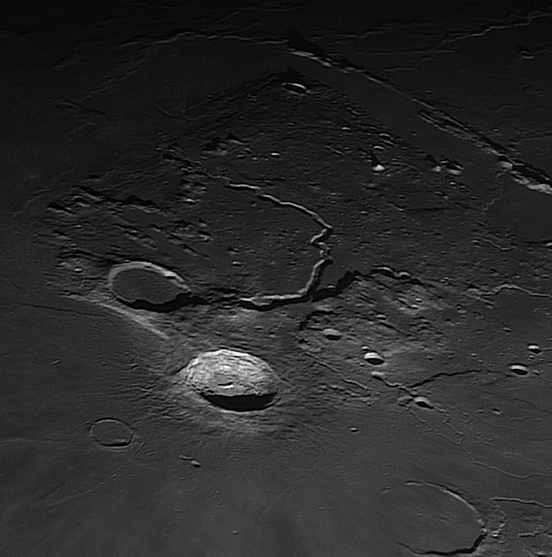
Aristarchus [R:1038×0.35ms]


The area around Aristarchus has been the site of many ‘transient lunar phenomena’. These are reports of temporary changes in the brightness, color or appearance of objects. Even Apollo 11 astronaut Michel Collins radioed a report verifying German astronomer’s reports of a bright glow in the Aristarchus region. There may be something to the reports as recent lunar spacecraft instruments have detected temporary increases in the radioactive element Radon-222. The half-life of that element is only 3.8 days so the release must have been very recent for the instrument to have detected it during an orbital pass.

Aristarchus (annotated) [R:1038×0.35ms]

Map generated by Virtual Moon Atlas

Aristarchus is named for the Greek astronomer Aristarchus of Samos(310-230 BC). The crater Herodotus is named for the Greek historian who lived from 484-425 BC. Schröter’s Valley is named after German astronomer Johann Schröter (1745-1816).

 Posted by at 11:49
Mar 012020
 

I was able to get a couple of images of the Moon tonight before the clouds moved in. The rising Sun was just high enough to highlight several rima on the southeast edge of Mare Vaporum (Sea of Vapors). This image has north to the left and lunar east towards the top. The second image is annotated with some of the lunar features that are mentioned here.

The crater Hyginus appears to be one of the few craters not formed by impact. Without the raised rim common in impact craters it is thought to be a lunar volcanic caldera. The rille associated with the caldera runs some 220 km.
 

The rille nearer the top of the image is Rima Ariadaeus. This rille is thought to have formed when two parallel faults pulled apart and the surface between them dropped forming a graben. It is 300 km in length.
 

The final set of rille are the Rimae Triesnecker just east of the 25 km wide crater that gives the rimae their name.

 Posted by at 23:04
Jul 192019
 

I dug through my picture archive to find an image which includes the Apollo 11 landing site. I took this picture on the 1st of July, 2017. This image just covers the location in the southwest corner of Mare Tranquillitatis (image’s upper right). Along with the location of Tranquility Base, are the craters that have been subsequently named for the three crew members of the mission.

Moon [(V) C:86×2.25ms]


The reference image below is a full color image. Note the ‘bluer’ appearance of the Sea of Traquility compared to the adjacent ‘seas’. This is due to a higher than average amount of titanium in the lunar regolith.
 
 Posted by at 23:39
Mar 012019
 

The sky cleared Monday morning so I was able to take a few images during some focus testing. It is relatively easy to focus on stars and the PTO uses software to bring the scope to focus for those images. It is much more difficult to focus on the Sun, the Moon or the planets. So, I am trying different techniques to see which one provides the best focus.

The images are just random portions of the lunar disk.

In the first, the curved sweeping mountain chain is the Montes Apenninus (Apennine mountains) which separates the lunar ‘seas’ Mare Imbrium (lower) and Mare Serenitatis(upper).

Moon (detail)[(V)201×0.207ms]


The second image shows the heavily cratered southern portion of the Moon. The southern pole lies just off the right edge of the image. The largest crater shown at the lower right is the crater Clavius. It’s the one with the internal curved set of increasing diameter craters.
 

Moon (detail) [(V)374×0.287ms]

 Posted by at 08:53
Jan 212019
 

I set up early Sunday afternoon to make sure I had everything I needed to record the eclipse on hand and in working order. I’ve learned my lesson trying to set up ‘just-in-time” for an astronomical event. Unfortunately, once it got dark it became apparent my daytime polar alignment using a compass was very, very wrong. But, I was able to bring the Moon into the camera FOV and kept up with the alignment offset by jogging the mount in between exposures.

This image was taken about 7 minutes prior to the Moon entering the shadow’s umbra. Visually, the Moon was just starting to show an obvious darkening along one side.

Moon [F:1×0.002s]


This shot was taken as the Moon was in the deepest part of the shadow. The color gradient shows the Moon was not passing directly through the center of the shadow but offset towards one side.
 

Moon [F:1×5.5s]


I was anticipating seeing some stars when the Moon was at its dimmest. In fact, under extreme stretching, there are dozens of stars visible in the image. The detail section below shows the two stars that are the easiest to see – left to right: HIP 40270 and HIP 40327, both in the constellation Cancer. They are magnitudes 7.84 and 8.38 respectively. The dimmest star in the field was well below magnitude 10.5. The polar alignment error is obvious in how much the stars are smeared with only a 5.5 second exposure.
 

Moon detail [F:1×5.5s]


The mount I was using is a German Equatorial Mount (GEM). That design cannot track from horizon to horizon without hitting itself or the scope hitting the tripod. Because of this, when pointed vertically, the mount must flip its orientation from one side to the other. This is know as a meridian flip. Luckily, by the time it became necessary to flip, the eclipse was starting to wind down. Due to the poor polar alignment, once the mount flipped I could not bring the Moon back into the camera FOV quickly enough to continue the series of timed photos that I had planned. I also noticed some dew had started to form on the equipment so I used that as my excuse to wrap up the session and take the equipment into the nice, warm observatory office.
 
This morning, as usual, I took a look at the previous night’s SQM trend chart. It shows the measured brightness of the sky above the PTO. This surprised me some. It shouldn’t have, I should have anticipated the readings but I didn’t. The readings show the brightness of the sky. The higher the number, the darker the sky. The chart also shows the height of the Moon as small yellow circles. As you can see, as the Moon climbed higher in the sky, the brighter the sky became. That is until the Earth’s shadow reduced the light getting to the Moon. In fact, the chart shows the darkest part of the entire night was the time during the eclipse.
 

SQM trend chart

 Posted by at 19:36