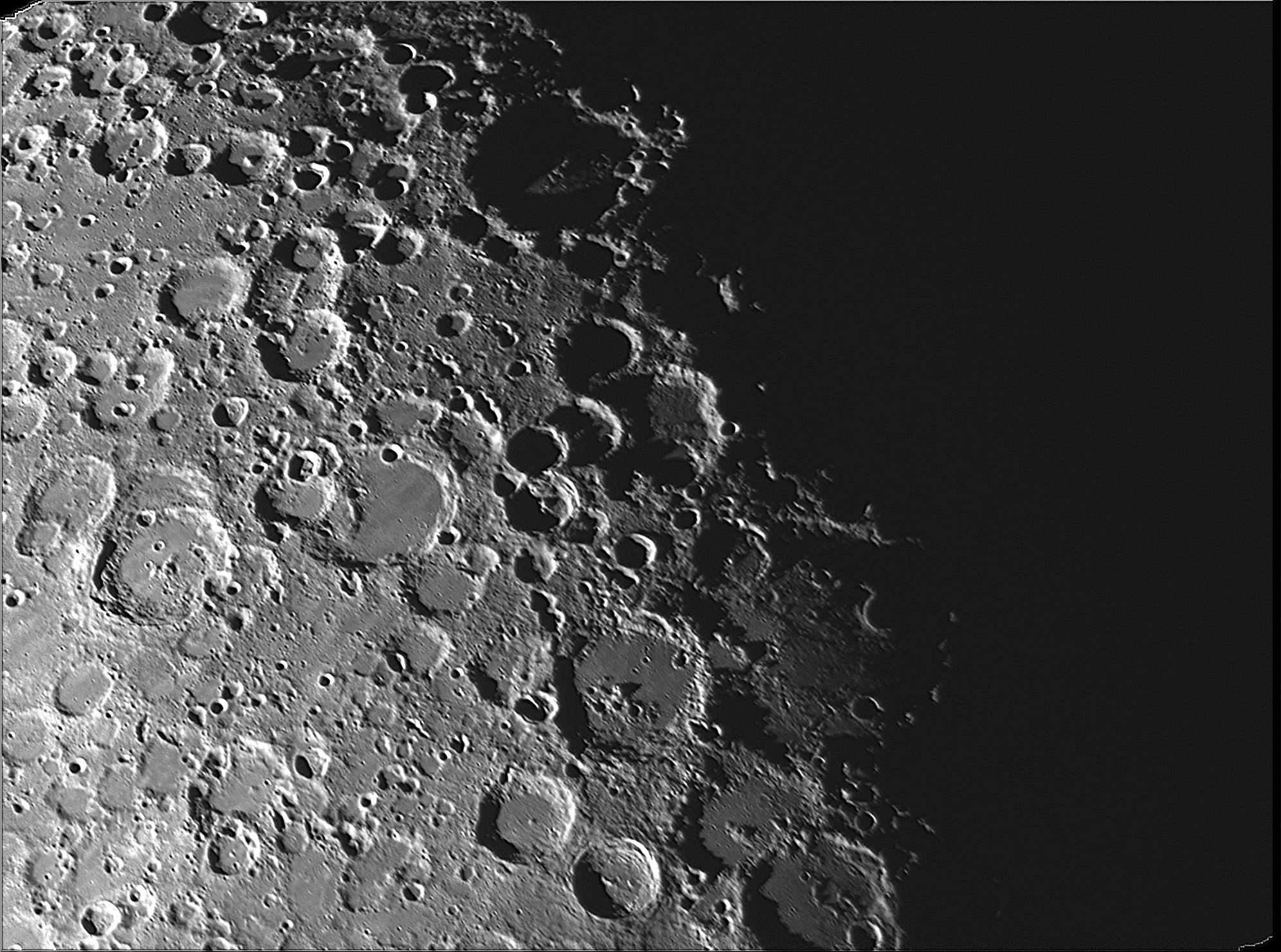
After wrapping up the last JunoCam series on the 1st I noticed that the Moon was in a good position to get some terminator images. The Moon’s terminator is the line dividing the daytime side of the Moon from the nighttime side. So, at the terminator, the Sun appears to be rising or setting. This puts the light from the Sun hitting that area of the Moon at a very low angle. At that low angle, mountains and crater walls cast long shadows providing a noticeable 3D effect.
The image below is a heavily cratered area of the south central section of the Moon. The large, deeply shadowed crater towards the top center of the image is crater Maginus. A notch in the crater wall allows a beam of sunlight to spear into the shadows illuminating an area of the crater floor.
Also visible toward the bottom, again deep in shadows, is a crater rim just catching the rising Sun. In fact, the illuminated rim looks like a sickle with the pointed end angled to the right. This is the rim of crater Hell. No, not that Hell. The crater is named for the Hungarian astronomer and Jesuit priest Maximilian Hell. He was appointed director of the Vienna Observatory in 1756.
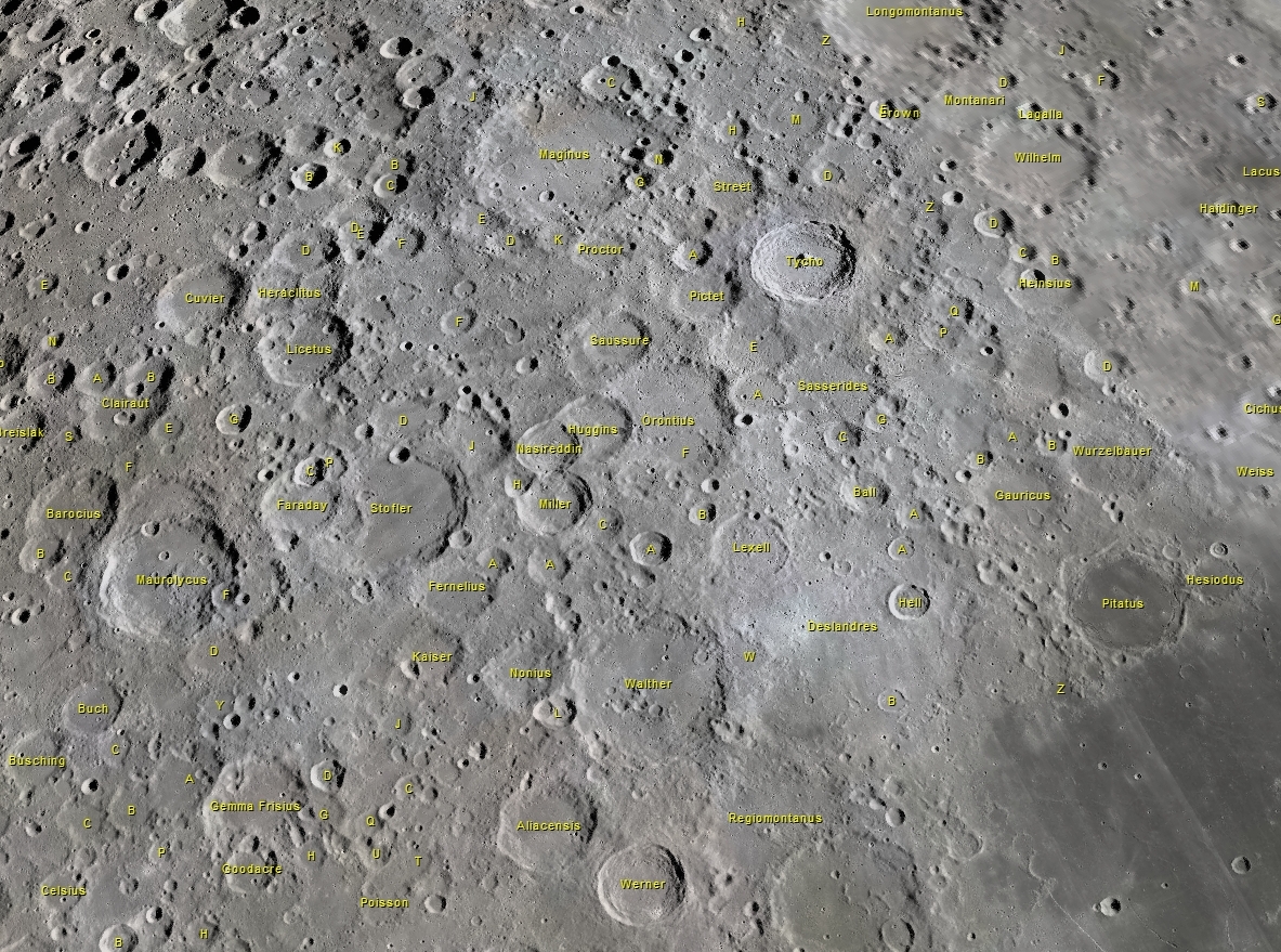
Map generated with Virtual Moon Atlas
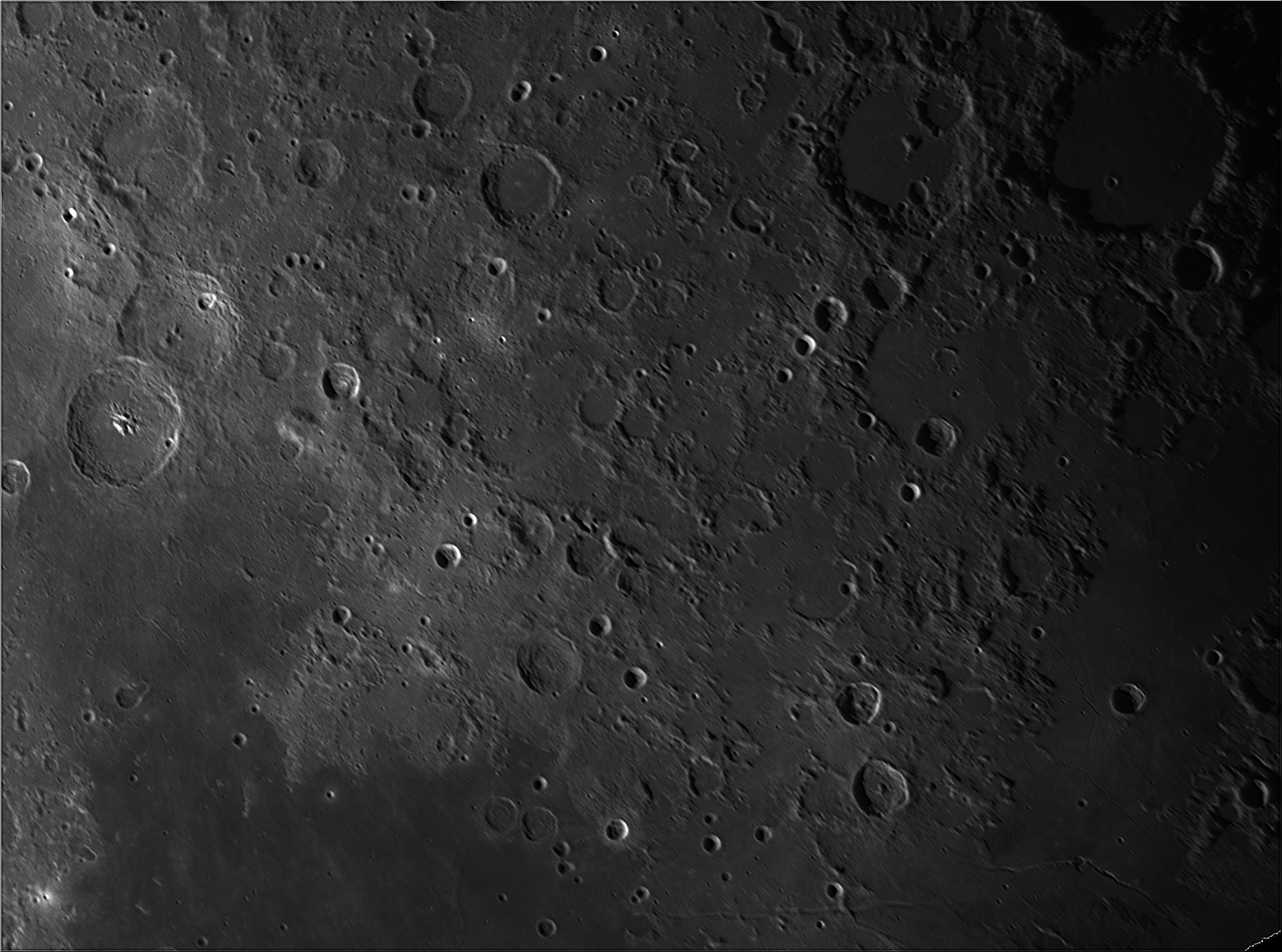
The next image is from a little farther north. The dark area to the lower left is the southern portion of the Sea of Tranquility. Of note in this image are the two rilles toward the bottom center and right. A rille is a long narrow depression that looks like a channel. The horizontal rille at center bottom is Rima Ariadaeus. Rima is the latin name for a rille. Rima Ariadaeus is over 180 miles long and was formed when the surface of the Moon pulled apart at parallel faults and the section of crust between sank.
The other rille, Rima Hyginus, is split into two sections by the crater Hyginus. However, this crater is not an impact crater. It is a volcanic caldera. So, the associated rille is thought to be formed by ancient collapsed lava tubes. It is most visible in the section to the right of the crater. Upon close examination it appears the roof of the tube collapsed in a series of connected craters.
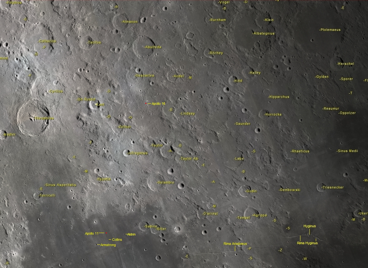
Map generated with Virtual Moon Atlas
Also visible in the above image are the landing sites for Apollo 11 and 16. Apollo 11 is in the southern part of The Sea of Tranquility along with the three craters named in honor of the crew members. The Apollo 16 landing site is further south just to the right of the small but prominent crater Kant which is right of the largest crater Theophilus.